
Twin Cities Severe Threat - May 9, 2022
North of the 45th
Twitter: https://twitter.com/BG2IceFishing
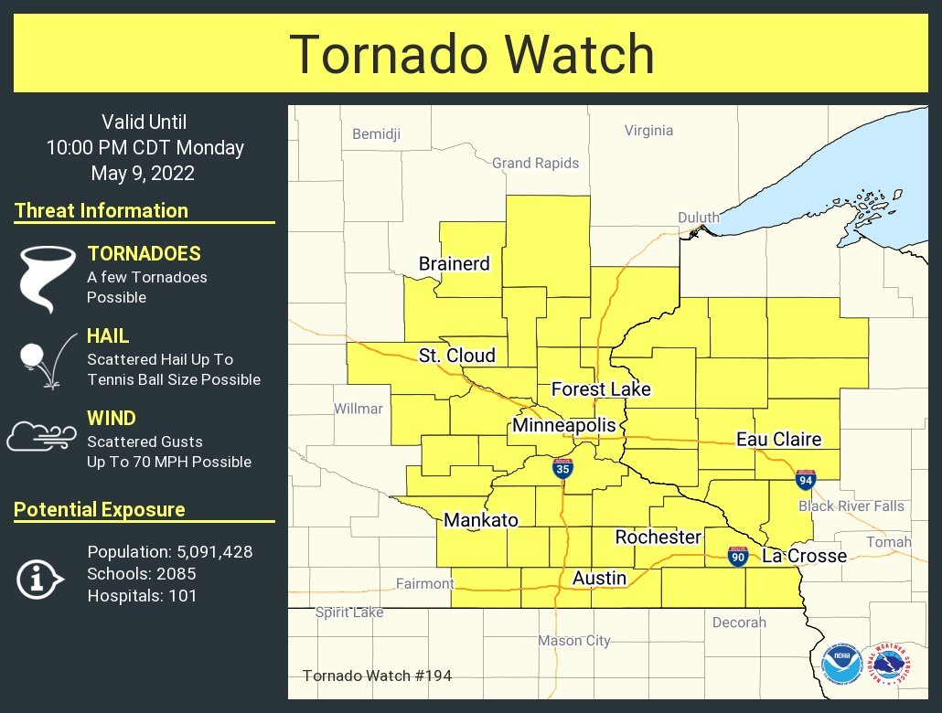
A tornado watch has been issued for parts of Minnesota and Wisconsin until 10 PM CDT
After a sluggish “Spring” it feels a lot more like Spring today as a warm front worked across the Twin Cities region this morning between 8 AM and 11 AM, bringing strong to severe storms from the southwest to the northeast.
These strong to severe storms were responsible for several reports of large to very large hail ranging between 1.00” (quarter size) up to 2.75” (baseball size) across southern and central Minnesota this morning. Luckily once these storms reached the Metro, smaller hail was being reported. Below, you can see some of the large hail reported across parts of the state.
In addition to the hail, strong winds were reported, with a few reports of minor wind and tree damage reported across the region. You can find a graphic from the National Weather Service Twin Cities at the end of this article showing the wind and hail reports from all across the region, along with a video at the end of the article of some shocking lightning that occurred in southeast Isanti County. This was not our last round of severe weather though for today.
Video captured by: Anne Jones
Twitter: https://twitter.com/1neatgirl
Second Round of Severe Weather
As the warm front worked off to the north-northeast that put the Twin Cities region in the warm sector with additional strong winds out of the south-southeast that will usher more warm, moist air across the region increasing instability this afternoon. These strong southerly winds are what warranted a Wind Advisory to be issued across the region until 7 PM for sustained winds of 25 to 35 mph, and gusts up to 50 MPH at times. The second round of severe is forecast during the late afternoon through the evening hours as the latest model guidance as showers and storms developing around 3 PM to the west of the Metro, will advance off to the east-northeast into the evening hours.
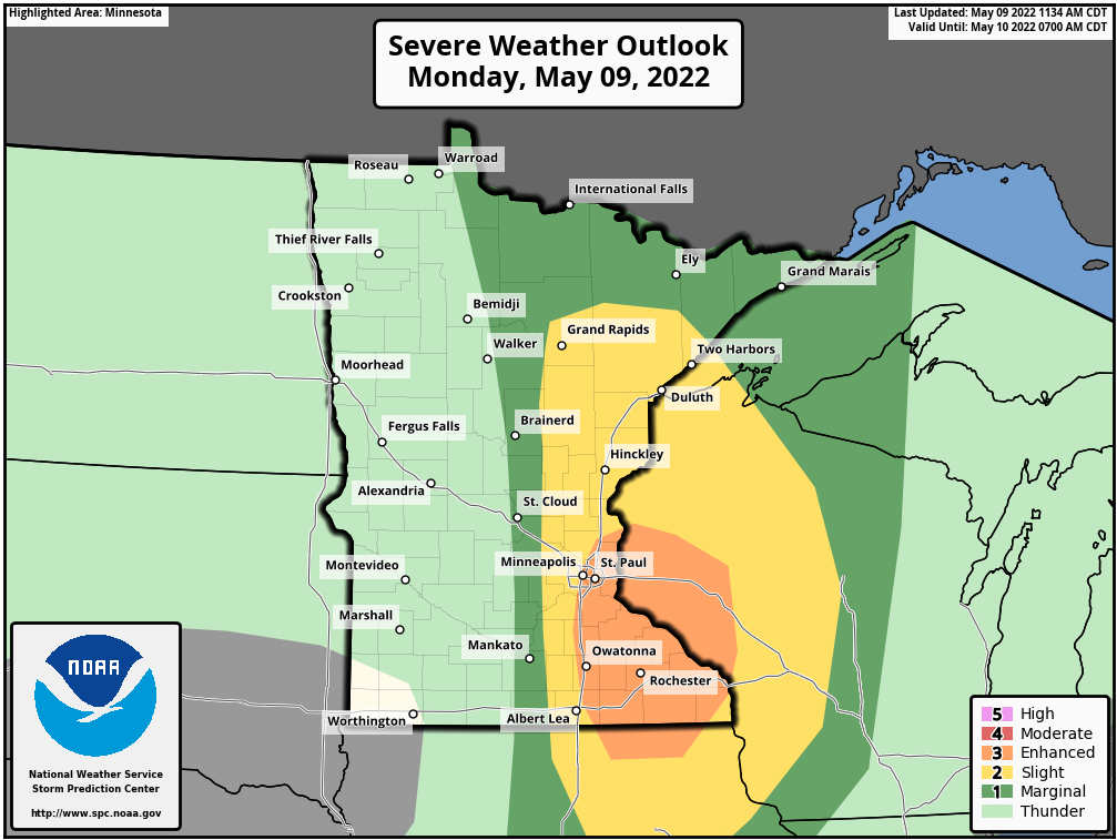
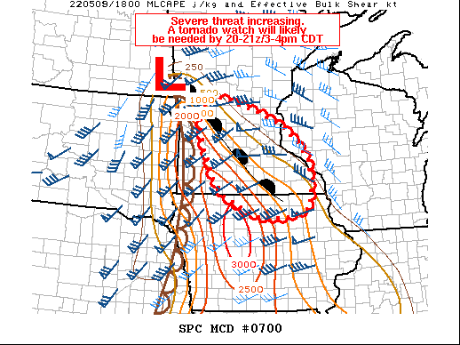
Strong wind shear, which is winds that change in speed and direction with height, is forecast across the region, which will support the threat of supercells, and all modes of severe weather, including large to very large hail, damaging winds, and a few tornadoes. Due to this threat of strong wind shear and what models are predicting is a very unstable environment, the Storm Prediction Center (SPC) has upgraded the threat of severe weather across the region to an Enhanced risk across the Metro (3 out of 5).
With the threat of all modes of severe weather forecast across the region, it is important to remember to have multiple ways of receiving severe weather alerts, a weather radio being one of the most important tools you could have in your home or business. Additionally, with the threat of large to very large hail likely and a tornado possible across the metro, it is important to remember to NEVER seek shelter under an overpass. That is simply one of the worst places you could ever take cover.
TORNADO WATCH LIKELY
The Storm Prediction Center will likely be issuing a Tornado Watch between 3-4 PM LT. When it is, we will update this article with the latest details.
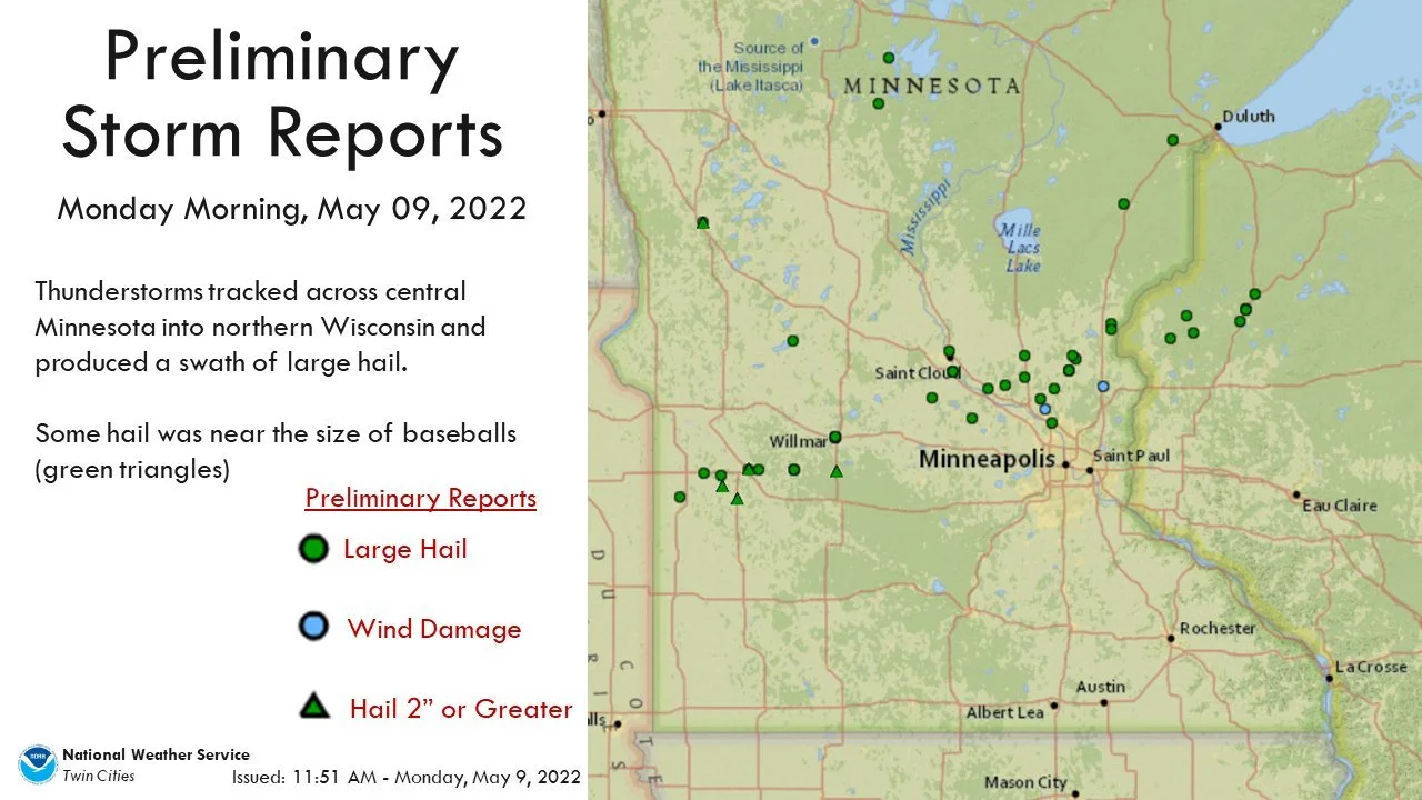
Wind damage and hail reports across the regional from the NWS Twin Cities
Video captured by Kate:
Twitter: https://twitter.com/LeftyKate4